The History of English Counties
How Anglo-Saxon shires became England’s counties
The counties of England have a long and complicated history. Many of the names we recognise today can be traced back more than a thousand years, to the Anglo-Saxon kingdoms that existed before England itself was united.
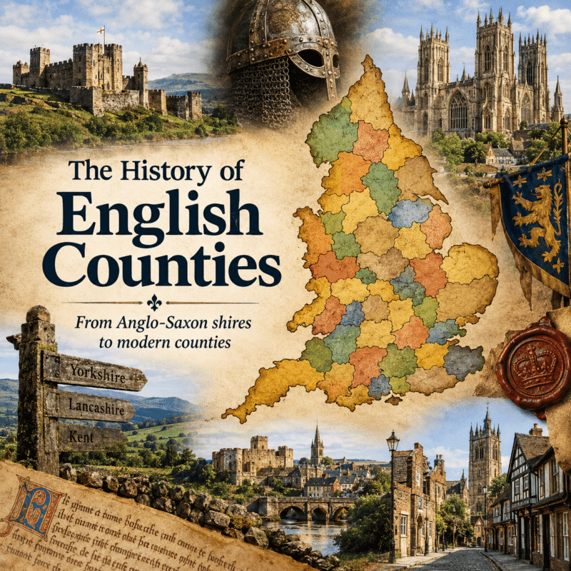
Although county boundaries have been repeatedly altered, divided and reorganised, the origins of many historic counties lie in the shires established by the Anglo-Saxon kings.
The word county itself comes from the Old French comté, meaning the territory of a count, and became widely used following the Norman Conquest. Before 1066, however, these territories were generally known as shires.
The origins of the shires
As the Anglo-Saxon kingdoms expanded, their territories were divided into administrative districts known as shires. The system developed particularly extensively in the Kingdom of Wessex and was gradually extended as the West Saxon kings conquered and incorporated other parts of England.
A shire was governed on behalf of the king by important officials. The ealdorman was a senior nobleman who represented the king, commanded the military forces of the shire and played an important role in its government. Alongside him was the shire-reeve, the king’s official responsible for financial administration and the enforcement of royal authority. The title shire-reeve eventually became sheriff, a word still used today.
The exact origins of individual shires are not always clear. Some appear to have developed from much older kingdoms or tribal territories, while others were created as Anglo-Saxon rulers extended their authority.
The counties of Kent, Sussex and Essex, for example, broadly corresponded to the territories of former Anglo-Saxon kingdoms. In Wessex, meanwhile, shires such as Hampshire, Wiltshire, Dorset, Somerset and Devon had emerged by the late Anglo-Saxon period, although their precise origins are sometimes uncertain.
During the 10th century, as the kings of Wessex conquered the remaining Anglo-Saxon and Viking territories, the shire system was extended across much of England.
Hundreds and wapentakes
The shires were divided into smaller administrative districts known as hundreds. These were important units of local government and justice, each containing a number of settlements and estates.
The name “hundred” probably reflects an early system based on a particular number of households or hides of land, although its precise meaning varied over time.
In areas formerly controlled by the Vikings, particularly northern and eastern England, the equivalent districts were often known as wapentakes. The word is associated with the Old Norse vápnatak, referring to the raising or displaying of weapons as a symbol of agreement.
Hundreds and wapentakes provided a framework for local courts, taxation and the administration of royal authority.
At the heart of many districts were towns and fortified settlements known as burhs. Originally developed as defended centres, particularly during the reign of Alfred the Great and his successors, burhs became important centres of administration and trade.
The former Anglo-Saxon kingdoms
The development of England’s counties was closely connected with the disappearance of the independent Anglo-Saxon kingdoms.
By the 9th century, England was divided between several major kingdoms and territories, including Wessex, Mercia, Northumbria and East Anglia. The Viking invasions transformed this political landscape, particularly in northern and eastern England.
East Anglia, for example, was an Anglo-Saxon kingdom occupying territory broadly corresponding to modern Norfolk and Suffolk, together with parts of neighbouring counties. It was conquered by the Vikings in the 9th century and later incorporated into the expanding English kingdom.
The kingdom ceased to exist as an independent political entity during the early 10th century, and its territory subsequently became part of the developing administrative structure of England.
Other former kingdoms followed a similar path. Mercia was gradually absorbed into the kingdom ruled by the kings of Wessex, while Northumbria became divided between English and Scandinavian territories before eventually being incorporated into the English kingdom.
The county map therefore reflects, in part, the political history of Anglo-Saxon England.
The Norman Conquest
When William the Conqueror invaded England in 1066, he inherited a sophisticated system of local government rather than creating the counties from scratch.
The Normans retained the shires and hundreds, adapting them to their own system of government. Royal officials such as sheriffs became increasingly important, while powerful Norman nobles were granted large estates and, in some cases, authority over groups of counties.
The Domesday Book of 1086 provides one of the most remarkable records of England’s counties and their landholding system. Commissioned by William I, it recorded landowners, estates, resources and taxable assets across much of England.
The counties recorded in Domesday were recognisably the ancestors of many historic counties that survived for centuries afterwards.
Medieval counties
During the Middle Ages, the counties became increasingly important parts of English government.
County courts dealt with legal and administrative matters, while sheriffs represented royal authority within each county. The counties also became important for taxation and military organisation.
Some counties developed unusual arrangements because of their history.
The County Palatine of Durham, for example, was governed for centuries by the Bishop of Durham, who possessed unusually extensive powers within the county. Cheshire also had a special status as a county palatine, reflecting its strategic importance on the Welsh border.
Yorkshire developed into one of England’s largest counties and was eventually divided into the three Ridings — the East Riding, North Riding and West Riding — as well as the city of York. The Ridings were not simply geographical divisions; they developed their own administrative identities.
Other historic counties emerged or were reorganised during the medieval period as England’s government expanded.
Counties and the Tudor state
By the Tudor period, counties had become firmly established as the principal units of local government.
The appointment of Justices of the Peace gave the counties an increasingly important role in local administration. These local landowners administered justice, enforced laws and dealt with matters ranging from roads and poor relief to public order.
The counties also played an important military role. During periods of war or rebellion, men could be raised from across the counties for royal service.
County identity consequently became deeply rooted in English society. People increasingly identified themselves not only with their town or village but also with their county.
The growth of towns and county boroughs
For centuries, England remained predominantly rural, and county boundaries changed relatively little. The Industrial Revolution transformed this situation.
During the 18th and 19th centuries, towns such as Manchester, Liverpool, Birmingham, Leeds and Sheffield grew rapidly. Their populations and economic importance increasingly dwarfed those of many traditional county towns.
The growth of these industrial centres created problems for the traditional system of county administration. Large towns required services and forms of government that were difficult to manage within predominantly rural counties.
The Municipal Corporations Act of 1835 began a process of reform, while the Local Government Act of 1888 created elected county councils and established the system of administrative counties. Many large towns became county boroughs, operating independently of the surrounding administrative county.
This created an increasingly complicated distinction between the historic county and the area actually governed by a county council.
The counties of the 20th century
The 20th century brought further changes. Urban expansion continued, and local government increasingly had to deal with large metropolitan areas that crossed traditional county boundaries.
In 1974, one of the most significant reorganisations of local government in English history took place.
The Local Government Act 1972 created a new system of metropolitan and non-metropolitan counties. New counties appeared, including Greater Manchester, Merseyside, South Yorkshire, West Yorkshire, West Midlands, Avon, Cleveland and Humberside.
At the same time, many historic counties were divided or their administrative boundaries were substantially altered.
For example, the historic county of Lancashire lost much of its territory to Greater Manchester and Merseyside, while Yorkshire was divided between several new administrative counties.
These changes did not necessarily erase the historic counties. Instead, England acquired several overlapping geographical identities: historic counties, administrative counties, metropolitan counties and later ceremonial counties.
Historic counties and modern England
Further local government reforms in the 1990s and 2000s created many unitary authorities, producing an even more complicated administrative map.
Today, the word “county” can therefore mean different things depending on the context.
A historic county refers to the traditional geographical counties that developed over centuries. An administrative county is an area governed by a county council, while a ceremonial county is an area used for purposes such as the appointment of a Lord Lieutenant and High Sheriff.
There are also metropolitan counties and unitary authorities, which fulfil different administrative functions.
This explains why a place can sometimes appear to be in a different county depending on whether a historic or modern administrative map is being used.
The legacy of the Anglo-Saxon shires
Despite centuries of change, the influence of the Anglo-Saxon shire system remains remarkably visible.
Names such as Yorkshire, Lancashire, Derbyshire, Nottinghamshire, Warwickshire, Gloucestershire and Staffordshire preserve the memory of the places around which medieval administration developed. Other historic counties, such as Kent, Sussex, Essex and Devon, preserve the identities of much older Anglo-Saxon territories.
The boundaries have changed, governments have come and gone, and the way counties are administered has been repeatedly reorganised. Yet the historic counties remain an important part of England’s geographical and cultural heritage.
To understand the history of England is therefore also to understand its counties. Their names and landscapes preserve the story of Anglo-Saxon kingdoms, Viking settlement, Norman government, medieval administration, industrialisation and the changing shape of the English state.
More than a thousand years after the first shires began to emerge, their legacy can still be seen on the map of England today.
Did you enjoy this post?
I hope you found this post useful. I put a great deal of time and effort in to building, maintaining and populating the website. If you like, you could say a small thank you by buying me a coffee. You don't have to, but it would be nice :)
Buy me a coffee

Stay up to Date
Follow me on my journey and get notified whenever a new post is published by following Kings & Castles on Facebook.
Follow MeExplore The Map
Discover the hundreds of castles, churches, monasteries, cathedrals and other historic locations that I've personally visited across England and Wales. Search by location, explore nearby sites and plan your next historical adventure.
Share: