The Welsh Marches and the Marcher Lords
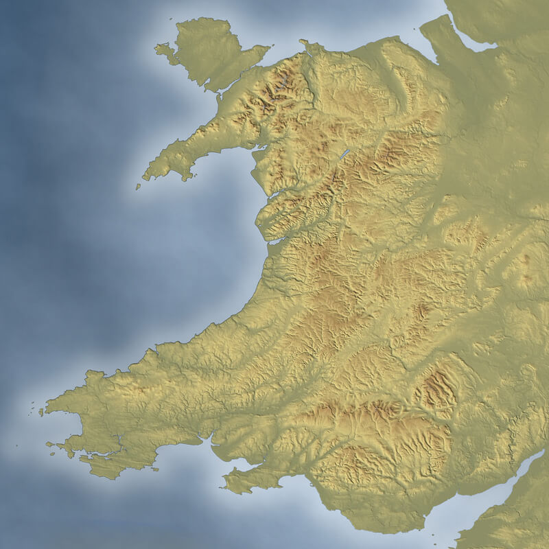
The Welsh Marches Today
The term ‘March’ comes from the Middle Ages meaning ‘border region’ or ‘frontier’ between two different areas.
The Welsh Marches is an area that lies along the border between England and Wales, roughly between the Welsh mountains and English rivers. The area has varied over the years as power has shifted between the Welsh and English nobility, but it doesn’t have an official or legal status today. It is a picturesque area made up of mountains, rivers and valleys, quaint villages and many castles.
Nowadays, the Welsh Marches refers to the English counties that lie along the Welsh border, such as Shropshire and Herefordshire. However, at one point the Marches also included Cheshire, Worcestershire and Gloucestershire, and large parts of Wales. Towns like Shrewsbury, Loeminster, Ludlow and Hereford once defined the border and marked the beginning of England. Today, border towns like Oswestry, Montgomery, Knighton and Hay-on-Wye are still not quite sure which side they are on.
Before the Marcher Lordship
The powerful Anglo-Saxon king Penda of Mercia established strong alliances with the Welsh kings in the 7th century, however, his successors sought to expand Mercia further westwards into what is now Cheshire, Shropshire and Herefordshire. As the power of Mercia grew, a string of garrisoned towns such as Shrewsbury and Hereford defined the borderlands.
In the 8th century, the Anglo-Saxons under the leadership of King Offa of Mercia built the first barricade along the borders, known as Offa’s Dyke, which still divides England and Wales today. Yet, it was only with the arrival of the Normans in the 11th century that the Marches were consolidated into a separate entity.
The Marcher Lordship
Immediately after the Norman Conquest of 1066, William the Conqueror, crowned William I of England, set up a buffer zone adjacent to the Welsh border to help establish his dominance over the Welsh and to quell the Welsh uprisings. King William created the Marcher Lordships, granting virtual independence to his most loyal supporters. The territories were collectively known as the Welsh Marches (Marchia Walliae in Medieval Latin).
The Welsh Marches were controlled by Marcher lords who held their lordships directly from the English crown, not the Welsh. Marcher lords ruled their lands as they saw fit, unlike their counterparts in England who were directly accountable to the king. These lords were very powerful, exercising near-independent rule within their territories, including the right to build castles, raise taxes, wage wars, establish towns and make their own laws.
William created the three earldoms of Chester, Shrewsbury and Hereford, which were the three largest cities and the three major Marcher centres of power. To govern them, he installed three of his most trusted barons, Hugh d’Avranches, Roger de Montgomerie, and William FitzOsbern, as Earls of Chester, Shrewsbury and Hereford respectively, with responsibilities for containing and subduing the Welsh. The number of Marcher lords increased over time as they raided across the border into Wales, and then fortified the areas they had taken against Welsh attack, giving more land to their supporters.
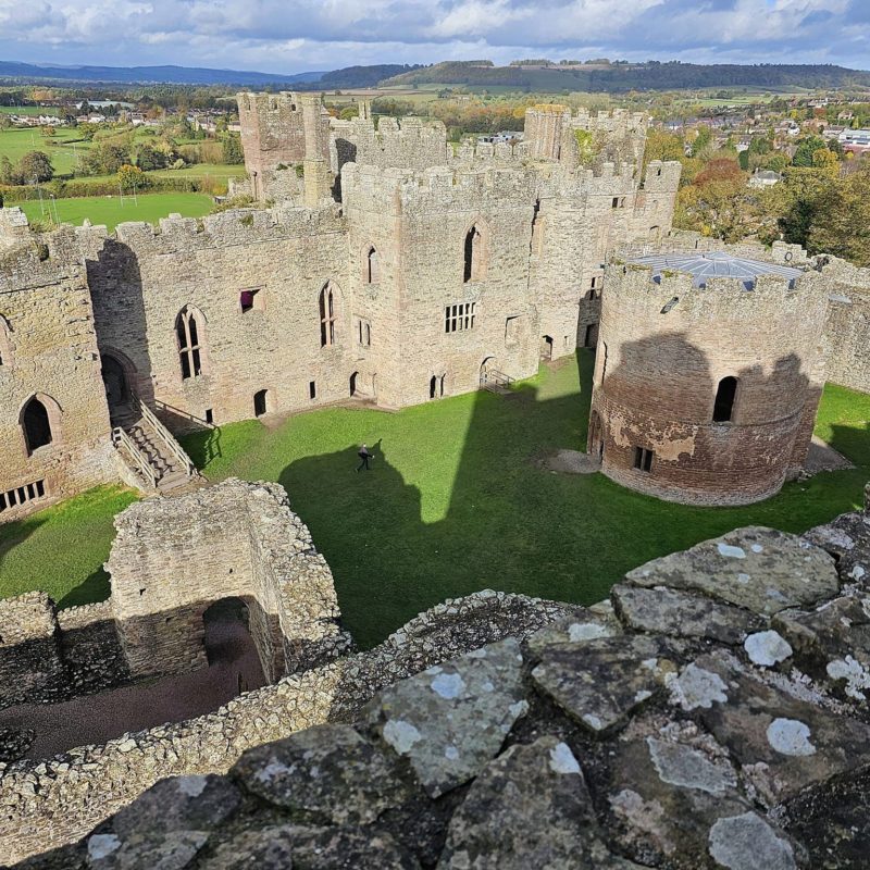
Many new towns were established, some such as Chepstow, Monmouth and Ludlow becoming successful trading centres. Border castles were also built at Chepstow, Monmouth, Goodrich, Clun, White, Skenfrith, Grosmont, Ludlow, Wigmore, Montgomery, Stokesay, Chirk, Bridgnorth, and many other border towns. This is why the area contains the densest concentration of motte-and-bailey castles in Britain. The Marches were a zone of constant tension and conflict between the English and the Welsh for centuries, with the Marcher lords playing a significant role in the history of both nations.
In the centuries that followed, English lords with lands on the border moved westwards, taking over Welsh lands and establishing individual Marcher Lordships. By the early 12th century, the Marches covered the areas which would later become Monmouthshire and much of Flintshire, Montgomeryshire, Radnorshire, Brecknockshire, Glamorgan, Carmarthenshire and Pembrokeshire. This amounted to about two-thirds of Wales, reducing the areas still under native Welsh control to parts of the west and north-west.
Despite this, the Welsh continued to raid and rebel against English rule. The borders and extent of individual Marcher lordships changed over the years, influenced significantly by the strength of native Welsh resistance. From time to time strong Welsh princes like Madog ap Maredudd, Owain Gwynedd, Llywelyn the Great, and Llywelyn the Last emerged to successfully reclaim parts of their country – for a time.
In 1284, the Statute of Rhuddlan was created by King Edward I of England during his conquest of Wales. This statute held that the lands that were once ruled by the Welsh Princes of Gwynedd under the title ‘Prince of Wales’ would legally become part of the lands of the Crown, part of England. New shire counties were established based on the English model and the Marcher lords were progressively tied to the English kings by the grants of lands and lordships in England, where control was stricter.
The Council of Wales and the Marches, a regional administrative body within the Kingdom of England, was established in 1472 by King Edward IV. For a large part of the 15th and 16th centuries the Council of Wales and the Marches was the most significant state-run institution in the western part of Britain. Headquartered at Ludlow Castle, its purpose was to govern the lands held under the Principality of Wales which had become directly administered by the English crown following Edward I’s conquest of Wales in the 13th century. Its area of responsibility varied but generally covered all of modern Wales and the English counties of Shropshire, Herefordshire, Worcestershire and Gloucestershire.
The End of Marcher Powers
The independence of the Marcher lordships continued until they were finally abolished by Henry VIII in 1536 under the Laws in Wales Acts 1535–1542. Some areas were organised into new Welsh counties such as Denbighshire, Montgomeryshire, Radnorshire, Monmouthshire and Carmarthenshire, and some were added to adjoining English counties; Ludlow, Clun and part of Montgomery were incorporated into Shropshire; Wigmore, Huntington, Clifford and most of Ewyas were included in Herefordshire; and a small part of Chepstow east of the River Wye was included in Gloucestershire.
Finally, the Council of Wales and the Marches was abolished in July 1689 following the Glorious Revolution of 1688 which overthrew James II and established William III (William of Orange) and Mary II as joint monarchs.
Did you enjoy this post?
I hope you found this post useful. I put a great deal of time and effort in to building, maintaining and populating the website. If you like, you could say a small thank you by buying me a coffee. You don't have to, but it would be nice :)
Buy me a coffee
Stay up to Date
Follow me on my journey and get notified whenever a new post is published by following Kings & Castles on Facebook.
Follow MeExplore The Map
Discover the hundreds of castles, churches, monasteries, cathedrals and other historic locations that I've personally visited across England and Wales. Search by location, explore nearby sites and plan your next historical adventure.
Share: